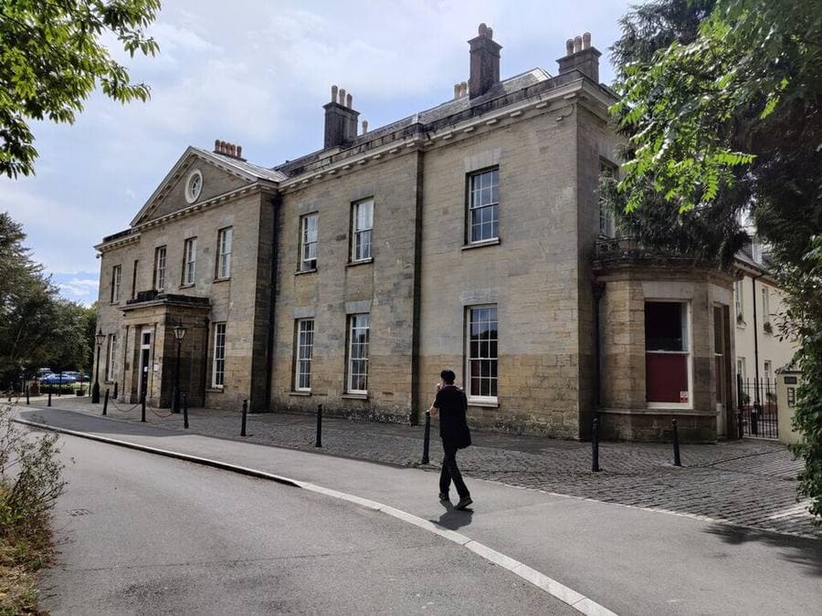
A major new heritage study is set to uncover more about the history of Stanmer Park, Brighton and Hove’s largest public space. Brighton and Hove City Council announced the project on 26 October 2026.
The council says the study follows a long collaboration with Historic England and a successful funding application through the Countryside Stewardship programme, and that it will help guide the long-term conservation of the landscape.
Cabinet Member for Sport, Recreation and Libraries Councillor Alan Robins said much of the park’s history is well documented but there is “still so much more for us to discover and learn”.
What the researchers will do
The work is being delivered by the consultancy Stantec in partnership with the council. According to the council, researchers will combine four methods: desk-based historical research, site walkovers, drone surveys and geophysical investigations, which look for buried features without digging.
The project team hopes to find more about evidence linked to Roman occupation, wartime activity and archaeological features that have not been recorded before. The council says the findings will also inform future conservation decisions and help protect important remains wherever possible.
How you will be able to follow it. Results will be shared through public content and an interactive digital StoryMap. The council says there will be three stages: a first update introducing the project, a second sharing emerging discoveries as fieldwork progresses, and a final article presenting the key findings and launching the finished StoryMap. It has not given dates for any of them.
What is already known about Stanmer
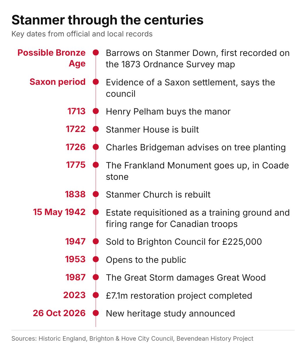
The council describes Stanmer as set in the South Downs National Park, with evidence of a Saxon settlement, 18th century agricultural buildings, a walled garden and a manor house built in 1722. In 2023 it described the estate as showing more than 5,000 years of human activity, with 27 listed buildings and structures, including the Grade I listed Stanmer House and the Grade II listed stables and church (council release).
Historic England’s register entry records that Henry Pelham bought the manor in 1713, that the Grade I listed house was built by Nicholas Dubois in the 1720s, and that the park is on the register of historic parks and gardens at Grade II, first listed on 20 January 2000. The same entry describes a village of mostly 18th century buildings with several listed Grade II, a church rebuilt in 1838 and a walled kitchen garden by Dubois.
What the Downs above Stanmer already show
Historic England has already looked at this landscape from the air. Its Changing Chalk: Downs from Above survey mapped 192 square kilometres of the South Downs north of Brighton and Hove between April 2022 and March 2023, drawing on more than 9,500 archive aerial photographs dating from the 1920s to 2018 and Environment Agency lidar. The team recorded archaeology from the Neolithic to the Cold War, including 247 confirmed or potential Bronze Age round barrows across the survey area.
Stanmer appears in several places in the report. Barrows on Stanmer Down were first recorded on the 1873 Ordnance Survey map, and field banks line up with possible Bronze Age barrows at the southern end of the down. Cropmarks show two similar sized enclosures near St Mary’s Farm on Stanmer Down, with a possible Iron Age enclosure against a lynchet, the stepped bank left by ancient ploughing on a slope.
The survey also recorded dewponds, the ponds linked to sheep farming on the Downs. The 1898 Ordnance Survey map shows a dewpond in Stanmer Park, now largely levelled, and the 1799 Stanmer estate map shows another opposite Coldean Lane that was levelled soon afterwards.
The Pelhams and the designed landscape
According to Historic England, the Michelborne family held the manor from 1615, and Henry Pelham bought it in 1713. Thomas Pelham inherited after 1725, and a later Thomas Pelham became the first Earl of Chichester in 1801. The Bevendean History Project says the Pelham family’s ownership lasted more than 230 years.
The council says the park landscape was developed in the style of Capability Brown. Historic England’s register entry tells the story differently: it says Nicholas Dubois built the house and apparently laid out the gardens in the 1720s, and that Charles Bridgeman advised on tree planting from 1726. It does not mention Capability Brown.
One of the estate’s landmarks is the Frankland Monument, put up in 1775. The listing describes a triangular Coade stone monument with a column resting on three tortoises, now headless, and a funerary urn on top. It was erected by Thomas, Lord Pelham, and his wife Ann in memory of her father, Frederick Frankland. The council says the monument was restored as part of its recent restoration project.
When the army took over the estate
The council notes that during the Second World War Stanmer was used to billet soldiers and provide firing ranges for a Canadian regiment, whose soldiers took part in the Dieppe Raid and followed on to the D-Day landings. A 2023 council release described the estate as a military training ground, including use by a Canadian tank regiment.
The Bevendean History Project records the detail. On 31 March 1942 the War Department told the Earl of Chichester that the estate would be requisitioned from 15 May 1942 as a training ground and firing range for Canadian troops. The village was designated for street fighting training, and all buildings were to be vacated within six weeks.
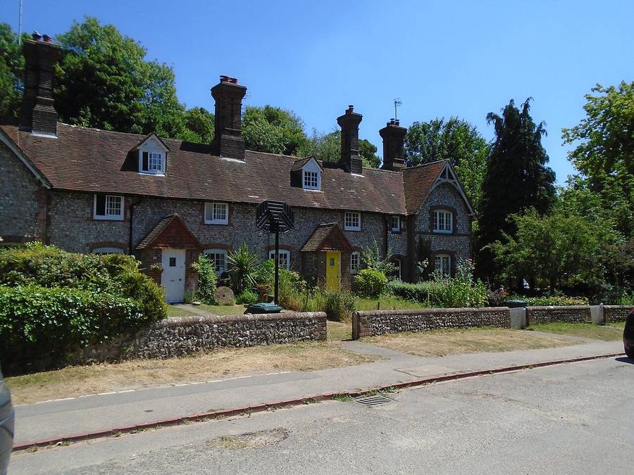
The project says cottage interiors were wrecked in the training, with hand grenades thrown through doors and windows, while farm buildings suffered most from heavy gunfire, and many were reduced to rubble. Standing orders placed Stanmer House and the church out of bounds, yet the house was still damaged by billeted Canadian troops.
The Bishop of Chichester signed an order closing Stanmer Church on 30 June 1942. The registers show it was not used again until around 1949, apart from one burial: John Buxton Pelham, the 8th Earl of Chichester, on 26 February 1944. After D-Day, unexploded ammunition was cleared from the estate, a job the project says was first carried out by Polish troops.
From private estate to public park
The Bevendean History Project says the 8th Earl’s death in 1944 and the death duties that followed led to a large part of Stanmer being sold to Brighton Corporation in 1947. Historic England records the price as £225,000. The corporation rebuilt the ruined flint and brick cottages as close to their original state as possible, and the area opened to the public in 1953.
Seven decades later the council announced the end of a six year restoration project in June 2023, costing £7.1 million, including a £4 million grant from The National Lottery Heritage Fund and The National Lottery Community Fund. It said the park gets about 500,000 visitors a year.
The work repaired the walled garden, now One Garden, whose new gardens were designed by Dominic Cole, and opened the Home Farm farmyard to the public for the first time. The council’s project page says more than 500 native trees were planted.
Stanmer today
The October 1987 storm hit Great Wood hard: the local history site My Brighton and Hove says it destroyed 45 per cent of the wood, the largest in Brighton. The conservation area was extended in 1988 to cover the park as well as the village.
The park’s Green Flag award is covered in our Stanmer Park Green Flag report, and our story on Louise Taylor’s Sown Together workshop covers a poetry workshop at the park.
Find your way around
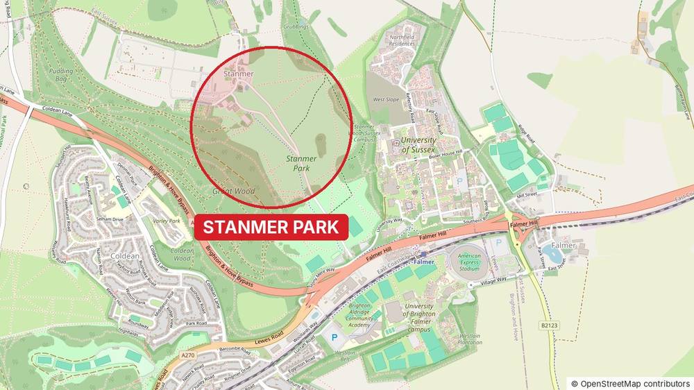
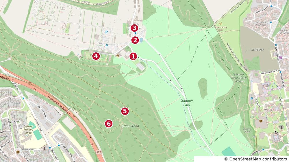
The map below marks the places named in this story: 1 Stanmer House, 2 Stanmer Church, 3 Stanmer village, 4 One Garden (the walled garden), 5 the Frankland Monument and 6 Great Wood. Positions are approximate.



Comments
No comments yet. Start the conversation.