
A259 Hove to Brighton Cycle Lane Plans: 70 New Parking Spaces and a New Two-Way Lane
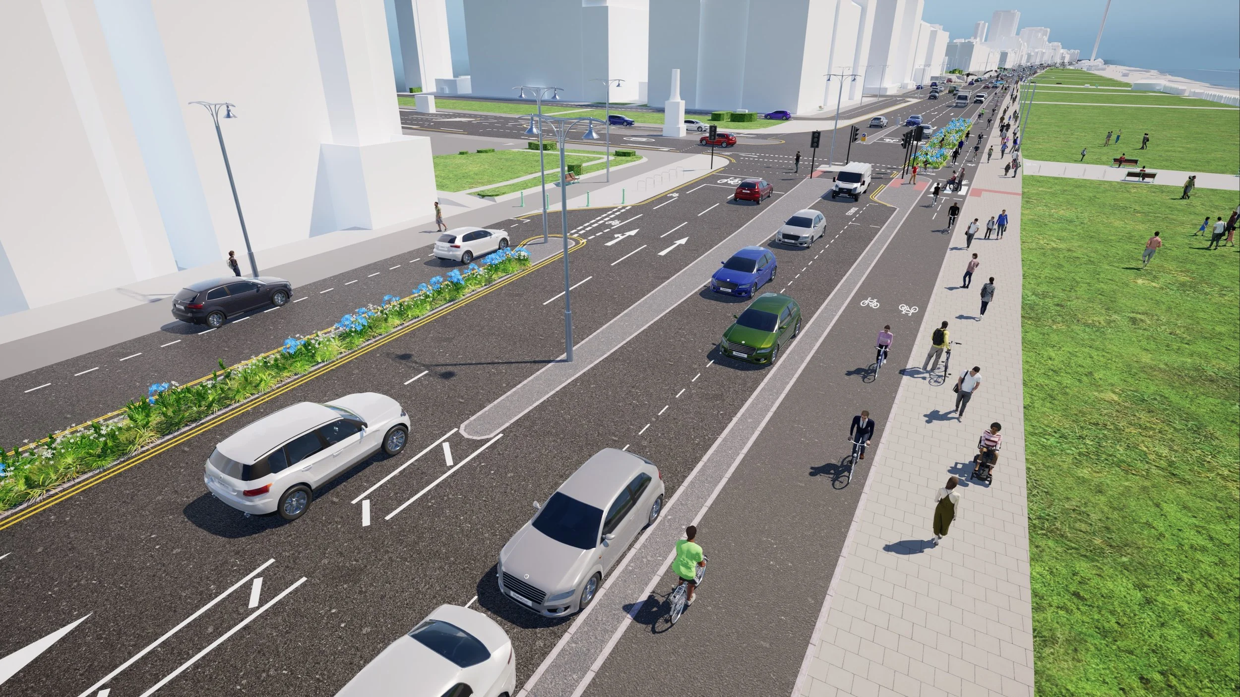
How the junction of Kingsway and Grand Avenue could look under the A259 plans. Image: Brighton and Hove City Council
Brighton and Hove City Council has opened a six week public consultation on the next stretch of the A259 Active Travel Scheme, covering the seafront between Fourth Avenue in Hove and West Street in Brighton. The plans would scrap today's split cycle lanes, including the westbound lane marked off from traffic by plastic wands, and replace them with a single two-way cycle lane separated from both traffic and pedestrians. The survey opened on 14 September 2026 and closes at midnight on Saturday 24 October 2026.
The scheme is backed by £780,000 from Active Travel England and nearly £4m allocated by the Department for Transport over four years. It includes around 70 new parking spaces, new pavements, safer crossings, loading and disabled bays and rain gardens, with improvements around Hove Lawns, the Bandstand, Shelter Hall, the i360 and the Brighton Centre. Two drop-in sessions are planned, the first at Hove Town Hall on Thursday 24 September.
Cllr Trevor Muten, Cabinet member for Transport and City Infrastructure, said:
"The A259 Active Travel Scheme is one of the most significant transport improvement projects in the city and these latest proposals continue our vision for a safer, more accessible and sustainable seafront for everyone.
"This next section will build on the scheme already being developed between Fourth Avenue and the city's western boundary, helping to create a continuous, high-quality route for people walking, wheeling and cycling along the coast.
"As well as improving cycling facilities, the proposals include safer crossings, better pavements and improvements to parking and loading provision, ensuring the space works better for everyone.
"I strongly believe in providing high-quality infrastructure that makes active travel an attractive option for more people. The current layout of the cycle lanes is confusing and we can do much better.
"We want to hear from as many people as possible. The views of residents, businesses and visitors are important in helping us shape the final design, so I would encourage everyone to take a look at the plans and have their say."
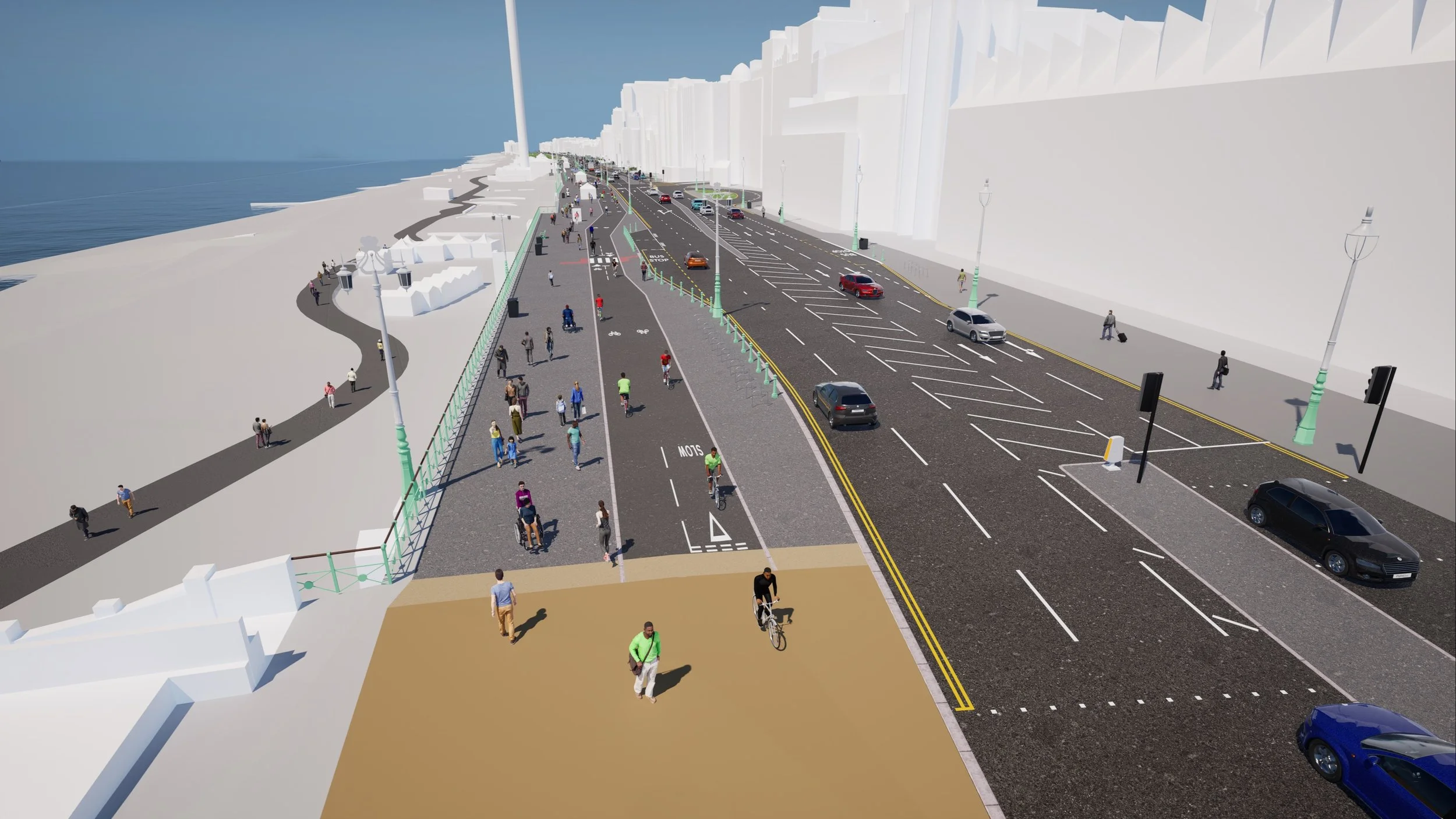
Looking west from the Peace Statue, as proposed. Image: Brighton and Hove City Council
What Changes on the Seafront
Today's layout dates back to August 2020, when a temporary westbound cycle lane was put in between West Street and Fourth Avenue during the Covid pandemic using emergency funding. It was later kept and made permanent. The council says the original cycle lane is too narrow for two-way cycling based on current user numbers and national design guidance, and that the westbound arrangement takes up a whole traffic lane.
The council's flythrough shows how the finished Hove to Brighton scheme would look along the seafront.
Video: Brighton and Hove City Council
The seafront now
Westbound cycle lane using a full traffic lane, marked off by plastic wands
Eastbound cycle lane running right next to the pavement
Sightseeing bus passengers stepping off straight into the cycle lane
A layout first installed as a temporary Covid measure in 2020
What is proposed
One two-way cycle lane separated from traffic and pedestrians
New pavements and safer, better aligned crossings and junctions
Around 70 new parking spaces, from disabled and loading bays to EV charging, paid and permit bays
Rain gardens to help deal with surface water
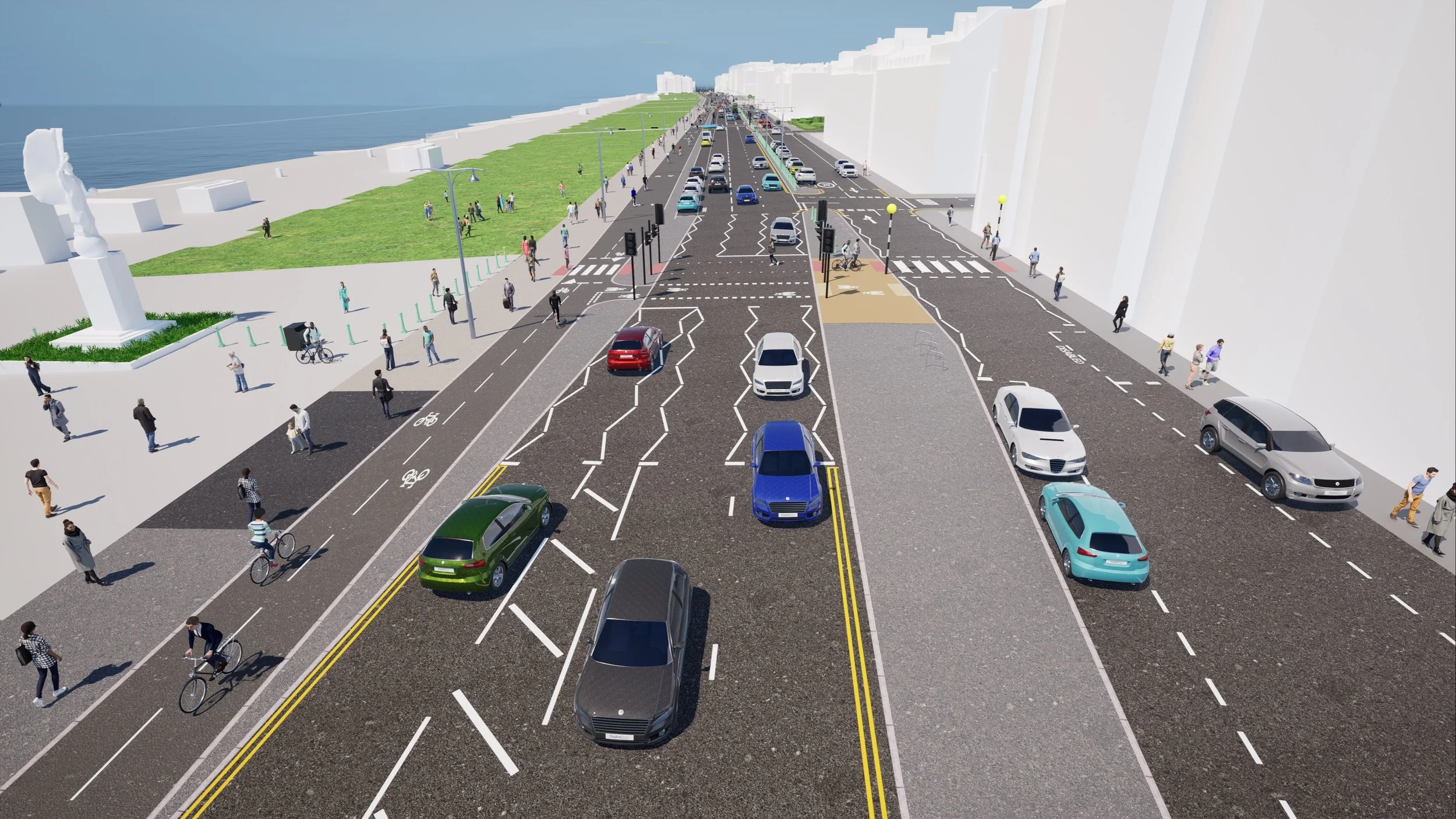
Looking west along King's Road from opposite the Brighton Centre, as proposed. Image: Brighton and Hove City Council
The Route: Phase 3 and Phase 4
The consultation covers two sections of the seafront. People can comment on either phase, both phases or the scheme as a whole. Phases 1 and 2, running from Fourth Avenue to the city's western boundary at Mill Road, Fishersgate, were consulted on in 2025 and are due to begin construction shortly, and feedback from those consultations has helped shape the designs now on the table.
Phase 3: Fourth Avenue to the Peace Statue
Phase 4: Peace Statue to West Street
The A259 is one of the key routes picked out for active travel improvements in the city's Local Cycling and Walking Infrastructure Plan and forms part of National Cycle Network Route 2. It is a busy route for commuters, residents and visitors heading to shops, businesses and attractions along the seafront. Completing the whole Hove to Brighton stretch depends on securing further funding, so the council plans to build it in sections, starting at the Fourth Avenue junction.
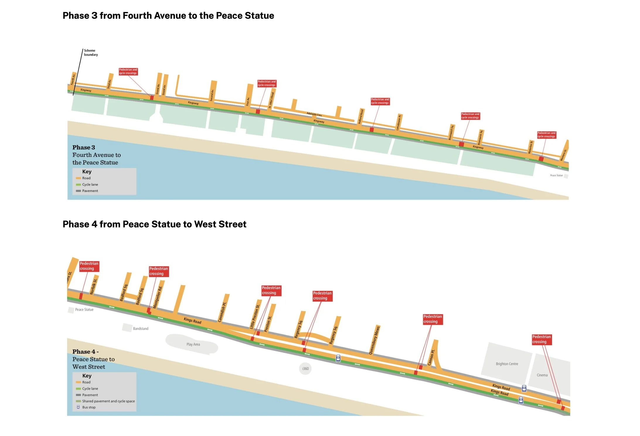
Phase 3 runs from Fourth Avenue to the Peace Statue, Phase 4 from the Peace Statue to West Street. Image: Brighton and Hove City Council
What the Drawings Show Along Kingsway and Hove Lawns
The technical drawings published with the consultation, dated August 2026 and drawn at 1:500 scale, set out the plans street by street. Sheet 1 covers Kingsway from Fourth Avenue past Kings Lawns and Adelaide Crescent. It shows the following.
Two-way cycle track with a 75mm kerb along Kingsway, running beside Kings Lawns
Rain gardens and sustainable drainage areas, at Kings Gardens near Third Avenue, beside the Grand Avenue junction and by First Avenue
A new traffic island position at the Grand Avenue junction
Parallel puffin crossings, which let people walk and cycle across side by side, at Queen's Gardens by First Avenue, outside Adelaide Mansions
New parking bays marked along Kingsway, plus disabled and loading only bays
Kerb realignments at St John's Road and Adelaide Crescent, new cycle stands, new benches still to be confirmed and a vehicle crossover for the lawns events space
Source: A259 Hove to Brighton Active Travel Scheme technical drawings, sheet 1 of 3
At its western end, the new track ties straight into the Fourth Avenue scheme heading towards the West Sussex boundary. The modern lampposts between Fourth Avenue and the Peace Statue would be moved to free up space for the cycle lane, pavements and extra parking. None of the heritage lampposts would be touched.
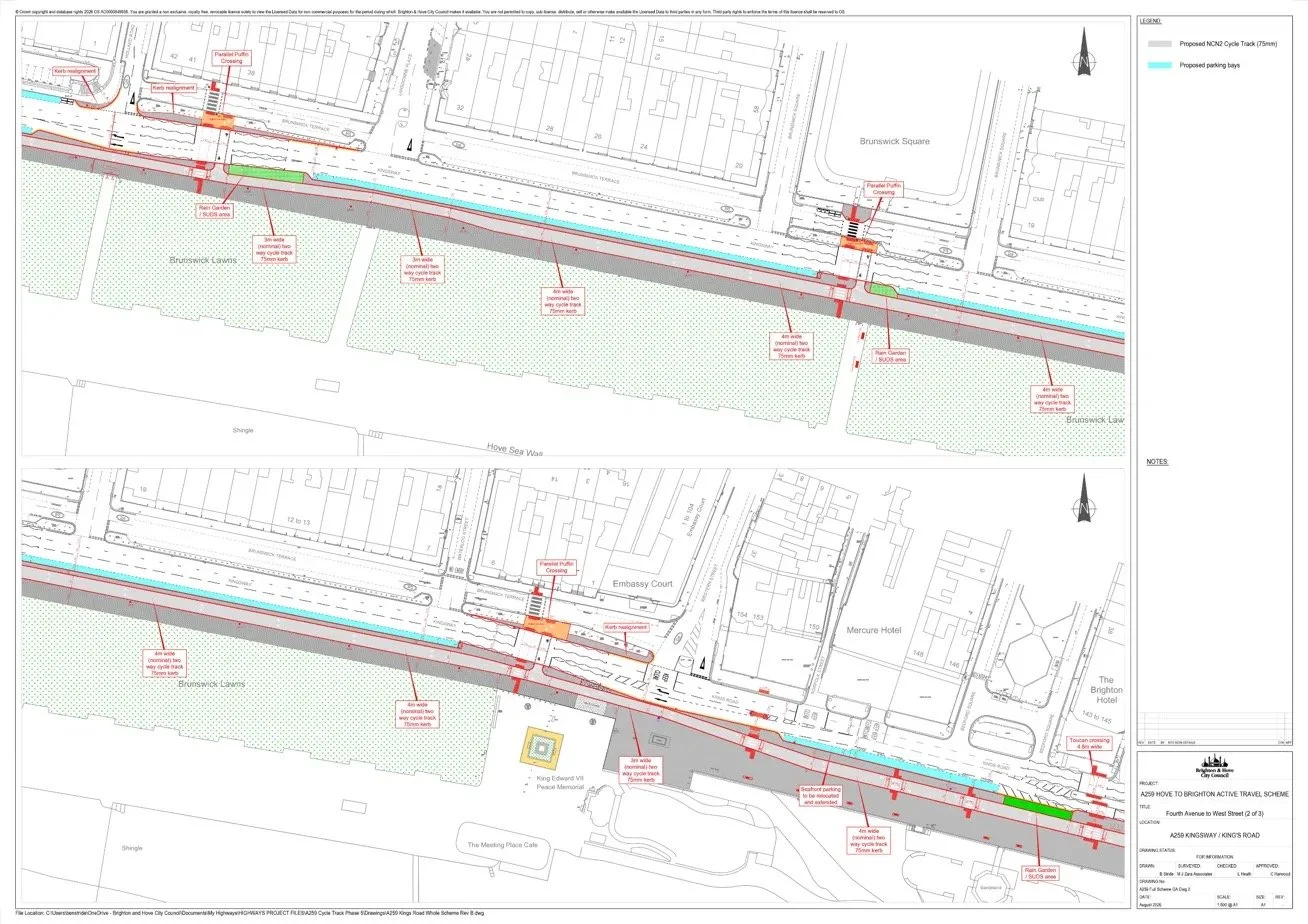
Technical drawing for Kingsway, Fourth Avenue to Adelaide Crescent. Image: Brighton and Hove City Council
What the Drawings Show from Brunswick Lawns to Bedford Square
Sheet 2 of the drawings covers the stretch past Brunswick Lawns, Brunswick Square, Embassy Court and the Peace Statue. Here the cycle track widens from 3m to 4m, still with a 75mm kerb, with new parking bays running alongside much of it. Stop by stop, this is what is planned.
Holland Road
Parallel puffin crossing, kerb realignments and a rain garden
Brunswick Square
Parallel puffin crossing and a rain garden
Waterloo Street and Embassy Court
Parallel puffin crossing and a kerb realignment
Peace Statue
3m cycle track past the King Edward VII Peace Memorial, by the Meeting Place Cafe
Norfolk Street to Bedford Square
Seafront parking relocated and extended, a rain garden and a 4.8m wide toucan crossing at Bedford Square
Source: A259 Hove to Brighton Active Travel Scheme technical drawings, sheet 2 of 3
Parallel puffin crossings sit walkers and cyclists side by side at the same signals, so people on bikes can cross without dismounting or sharing the pedestrian crossing.
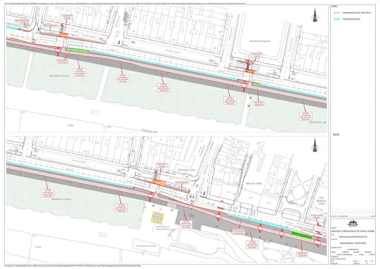
Technical drawing for Brunswick Lawns to Bedford Square. Image: Brighton and Hove City Council
What the Drawings Show Along King's Road
East of the Peace Statue, the cycle track widens to 4m with a 75mm kerb as it runs along King's Road towards the Brighton Centre. One of the biggest changes for drivers is marked at several points on the drawings: a westbound traffic lane reinstated, including near Little Preston Street, Regency Square and the Brighton Centre, as the wand-separated cycle lane is taken out.
Sheet 3 also shows a westbound lane merge near Montpelier Road, seafront parking relocated and extended near Oriental Place, a pavement level 3m cycle track past the i360, a crossing widened to 4.8m near Cannon Place and kerb realignments near the Brighton Centre. The scheme finishes at the existing shared use area outside Shelter Hall. Two bus stops on the route, both used by sightseeing buses, would be redesigned so passengers no longer step off into the cycle lane.
The same drawings mark the council's separate King's Road arch strengthening work, which overlaps parts of the route, along with areas of footway resurfacing:
| Arch strengthening | Arches | Timing |
|---|---|---|
| Phase 4 | 19 to 35 | 2026/2027 |
| Phase 5A | 125 to 139 | 2027/2029 |
| Phase 5B | 140 to 147 | 2027/2029 |
Source: A259 Hove to Brighton Active Travel Scheme technical drawings, sheet 3 of 3
All drawings are marked for information and could change as the design is finalised.
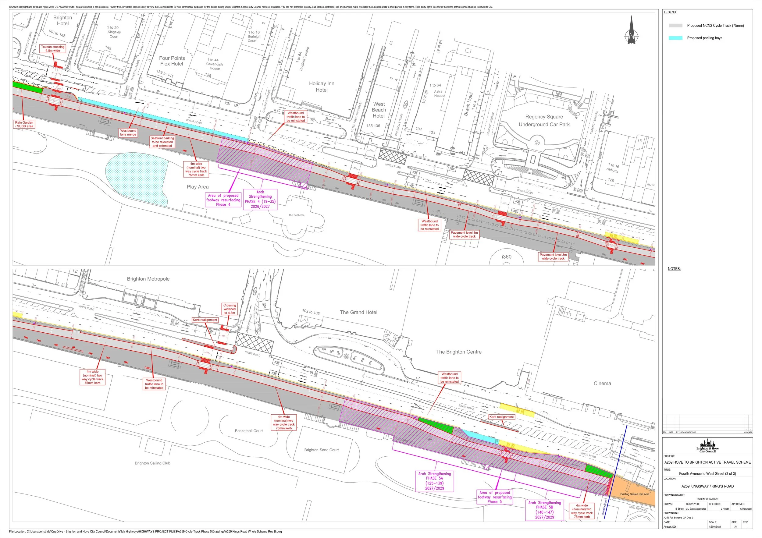
Technical drawing for King's Road, Bedford Square to Shelter Hall. Image: Brighton and Hove City Council
Parking, Money and Your Questions Answered
The money comes from two pots: £780,000 secured from Active Travel England, and nearly £4m allocated by the Department for Transport over four years. On parking, the council is proposing around 70 new spaces, bringing parking back to a busy stretch by replacing the temporary layout with a permanent one.
The council has answered the questions people ask most. Tap each one to read the answer.
What is wrong with the cycle lane already there?
It is too narrow for two-way cycling based on current user numbers and national design guidance, and the westbound lane uses a whole traffic lane separated by wands. A single two-way lane would simplify the layout, separate cyclists, pedestrians and vehicles, and free up room for new parking.
Will parking bays be removed?
No. Around 70 new spaces are proposed, including disabled bays, loading bays, new electric vehicle charging bays, paid parking and permit bays.
Are lampposts being moved?
The modern lampposts between Fourth Avenue and the Peace Statue would be relocated to make room for the cycle lane, better pavements and extra parking. None of the heritage lampposts would be moved.
Could the money be spent on potholes instead?
No. The funding cannot be used for maintenance and has to be spent on active travel improvements.
Will it all be built at once?
It may be delivered in phases as more funding becomes available. The council is consulting on the full scheme now so people can see and comment on the complete vision.
What about the conservation area?
The council says the designs will be sympathetic to the conservation area. Its conservation team has been consulted and will be involved further during detailed design, especially on materials.
Why are there rain gardens in the plans?
Sustainable drainage features, including rain gardens, are there to help manage surface water in areas prone to it. The added green space should also make the seafront more attractive.
Are any bus stops changing?
Two bus stops are directly affected, both used by sightseeing buses. Their layouts would be improved because passengers currently get off into the cycle lane.
When would work start?
The council hopes to start in late 2027 or early 2028, delivering in phases depending on funding.
Building on the Hove to Portslade Scheme
Phases 3 and 4 follow on from the A259 Hove to Portslade scheme between Fourth Avenue and the western boundary. That scheme went out to a six week consultation in summer 2025, drawing more than 900 responses, almost two thirds (65%) of them from people living in Hove and Portslade, with strong support for wider pavements, better crossings, upgraded cycle routes and improved public spaces. It then went through a statutory 21 day Traffic Regulation Order consultation in early 2026, and the design was changed as a result, including keeping the Tandridge Road bus stop where it is. That scheme is funded by £4.3m from Active Travel England and £2.7m of the council's Local Transport Plan funding spread over three years.
Here is the flythrough of the Hove to Portslade scheme as it was consulted on in 2025.
Video: Brighton and Hove City Council
Speaking about that scheme in May, Cllr Muten said:
"As we did after the public consultation last summer, we've listened carefully to the feedback and comments and made changes to ensure the scheme works for everyone. I know several residents were keen to keep the Tandridge Road bus stop where it is, and I'm pleased we've been able to do just that."
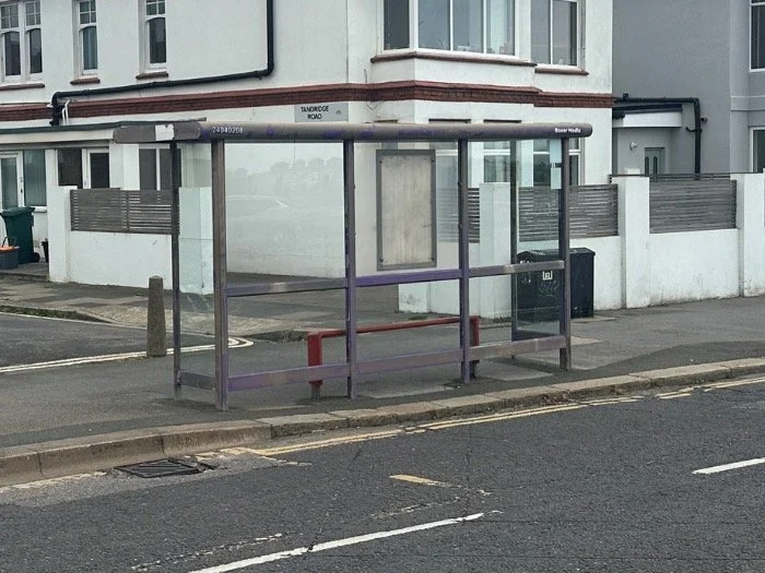
The Tandridge Road bus stop will remain following resident feedback. Image: Brighton and Hove City Council
What Happens Next
14 September to 24 October 2026
Public survey open, with drop-in sessions on 24 September and 17 October
26 October to 28 November 2026
Responses analysed and a summary published. Cabinet then reviews the feedback and any design changes before the design is finalised
April to May 2027
Traffic Regulation Order stage, the final chance to comment, with a 21 day comment period. If needed, Cabinet Members weigh up objections and support and decide whether the plans go ahead as they are, with changes, or not at all
From November 2027
If approved, the work goes out to tender, with construction hoped to start in late 2027 or early 2028 and delivered in phases depending on funding
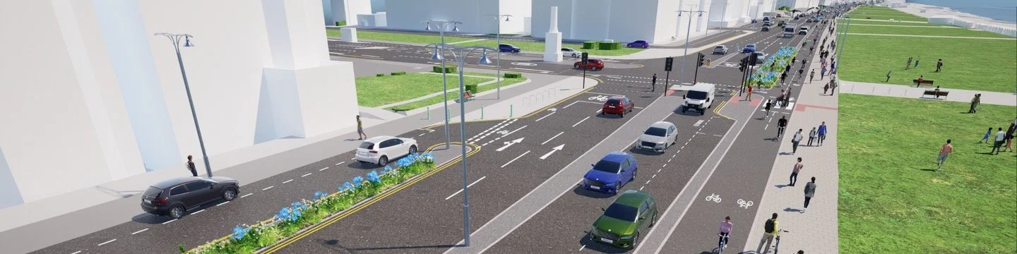
The proposed A259 layout on Kingsway, Hove. Image: Brighton and Hove City Council
Have Your Say Before 24 October
The survey takes around 10 to 15 minutes and you can answer about either phase or both. You can log in to save your progress and come back later. Anyone who wants to talk the plans through in person can drop in to one of two sessions.
|
24 SEPTEMBER 2026 Hove Town Hall Thursday, 3pm to 5.30pm |
17 OCTOBER 2026 Edward VII Memorial Saturday, 12pm to 3pm |
Traffic Regulation Order notices, including this scheme's when it reaches that stage, are published on the council's current Traffic Regulation Orders page.
More from ImJustBrighton
→ Western Road Closure and Bus Changes in Brighton → Brighton and Hove Council Clears 600 Drains Ahead of Autumn Storms → City Plan Scoping Consultation: Have Your SayHave Your Say Before 24 October
The survey takes around 10 to 15 minutes and you can answer about either phase or both. You can log in to save your progress and come back later. Anyone who wants to talk the plans through in person can drop in to one of two sessions.
|
24 SEPTEMBER 2026 Hove Town Hall Thursday, 3pm to 5.30pm |
17 OCTOBER 2026 Edward VII Memorial Saturday, 12pm to 3pm |
Traffic Regulation Order notices, including this scheme's when it reaches that stage, are published on the council's current Traffic Regulation Orders page.
More from ImJustBrighton
→ Western Road Closure and Bus Changes in Brighton → Brighton and Hove Council Clears 600 Drains Ahead of Autumn Storms → City Plan Scoping Consultation: Have Your Say