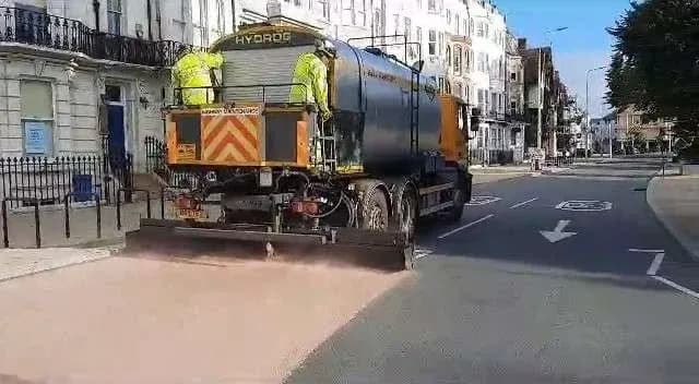
Brighton & Hove City Council is spending £8.8 million in 2026/27 on improving the city's roads, pavements and transport network, with 34 roads across the city treated or resurfaced this summer and a further 18 roads repaired for cracks and other damage.
£8.8 million to fix the city's roads
The programme is part of more than £8.8 million the council is spending in 2026/27 on the city's roads, pavements and transport network, funded by a grant from the Department for Transport. Brighton & Hove has over 390 miles of roads and cycle lanes and 750 miles of pavement.
Almost £4 million improving our roads
£2.2 million fixing immediate problems, such as potholes
Over £1 million making our pavements better
£200,000 accessibility improvements, including dropped kerbs
£360,000 safer roads, junctions and school streets schemes
More than £2 million helping to deliver major projects
"Our ongoing work to improve the city's roads will make journeys better, safer and smoother, fixing roads that have fallen into an unacceptable condition following years of underinvestment. Because of changes made to how funding is allocated, we now know what we'll be receiving for transport and maintenance from the Department for Transport for the next four years. This is more funding than before, and it means we're better able to plan and prepare for the future, improving travel transport for everyone."
Councillor Trevor Muten, Cabinet Member for Transport and City Infrastructure
Micro-asphalt: 23 roads getting the treatment
Micro-asphalt restores skid resistance, seals the surface and extends road life by 10 to 15 years. Work started with Fonthill Road, before moving onto Montpelier Road and Denmark Terrace.
The roads below were scheduled for treatment across July and August 2026; check the council's live page for current status, as some may already be complete.
View the full 23-road schedule
| Road | Location | Ward | m² | Date |
|---|---|---|---|---|
| Old Shoreham Road | Boundary Road – Holmes Avenue | Hangleton & Knoll | 15,912 | July 2026 |
| Coleman Street | Whole Road | Hanover & Elm Grove | 1,652 | July 2026 |
| Draxmont Way | Whole Road | Preston Park | 1,493 | July 2026 |
| Exeter Street | Whole Road | Preston Park | 1,893 | July 2026 |
| Fonthill Road | Whole Road | Goldsmid | 3,643 | July 2026 |
| Matlock Road and Tivoli Road | Whole Road | Preston Park | 3,464 | July 2026 |
| Montpelier Road | Montpelier Terrace – Clifton Hill | Regency | 2,095 | July 2026 |
| Clifton Hill | Whole Road | Regency | 2,051 | July 2026 |
| Russell Square | Whole Road | Regency | 1,195 | July 2026 |
| Silwood Street, Silwood Road, Oriental Street | Whole Road | Regency | 3,625 | July 2026 |
| Dyke Road Avenue | Woodland Drive – Barrowfield Drive | Westdene & Hove Park | 12,122 | August 2026 |
| Chalfont Drive | Whole Road | Westdene & Hove Park | 2,958 | August 2026 |
| Withdean Avenue | Whole Road | Preston Park, Westdene & Hove Park | 875 | August 2026 |
| Warren Road | Wilson Ave – Tenantry Down Road | Moulsecoomb & Bevendean, Hanover & Elm Grove, Whitehawk & Marina | 6,848 | August 2026 |
| Elm Grove | Freshfield Road – Sandown Road | Hanover & Elm Grove | 3,521 | August 2026 |
| Bernard Road | Whole Road | Hanover & Elm Grove | 2,647 | August 2026 |
| Sandown Road | Whole Road | Hanover & Elm Grove | 1,918 | August 2026 |
| Hangleton Way | Spencer Ave – Hardwick Way | Hangleton & Knoll | 2,868 | July 2026 |
| Preston Drove | Whole Road | Preston Park, Hollingdean & Fiveways | 10,302 | Not set |
| Stapley Road | Whole Road | Hangleton & Knoll | 4,126 | July 2026 |
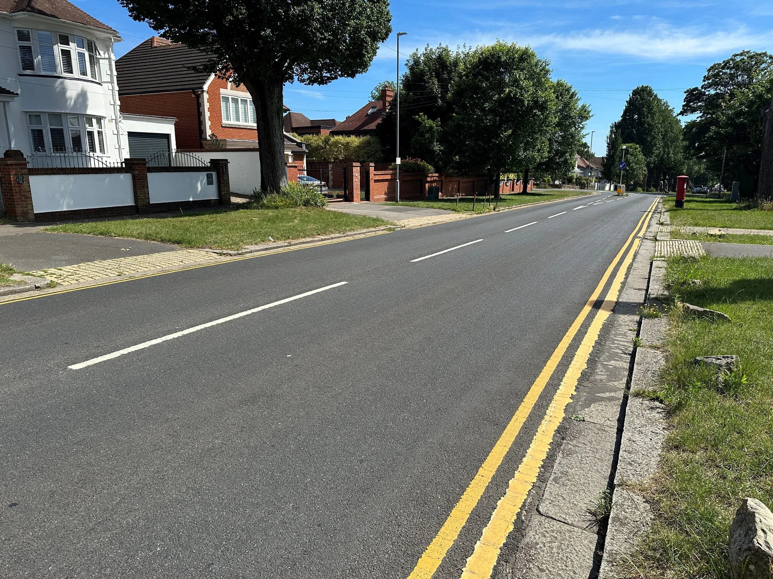
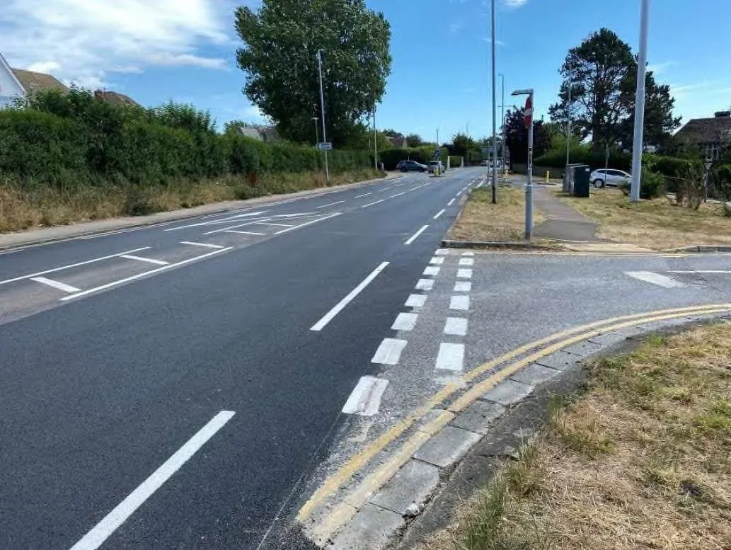
Fresh surfacing and road markings on one of the city's residential streets
Machine patching and full resurfacing
Machine patching repairs larger sections of failing road to extend its life, and is also used for pre-patching before surface extension treatments. Full resurfacing means the existing surface is removed to the required depth before being reinstated with new material. Both sets of roads are subject to change depending on tender returns and budget.
Machine patching: 18 roads at tender stage
| Road | Location | Ward |
|---|---|---|
| Boyces Street | Whole Road | Regency |
| Lewes Road | Southbound approach and junction with Wollards Way | Coldean & Stanmer |
| Mile Oak Road | North of A27 to authority boundary | North Portslade |
| Kingsway | Hove Street – opposite 151 | Westbourne & Poet's Corner |
| The Ridgeway | Ridgeway Gardens – Crescent Drive South | Woodingdean |
| Elm Grove | Bernard Road – Hallet Road | Hanover & Elm Grove |
| Hampton Street | Spring Street – Hampton Place | Regency |
| South Street | Whole Road | Regency |
| Hardwick Way | Hangleton Way – Hardwick Road | Hangleton & Knoll |
| Florence Place | Ditchling Road – Cemetery Access Point | Hollingdean & Fiveways |
| Craven Road | Junction with Queensway | Queen's Park |
| Western Terrace | Whole Road | Regency |
| Oxford Place | Junction with Ditchling Road | West Hill & North Laine |
| Rosehill Terrace | London Terrace – Kingsbury Road | West Hill & North Laine |
| Station Approach | Goldstone Villas – Denmark Villas | Goldsmid |
| Mackie Avenue | Whole Road | Patcham & Hollingbury |
| Carden Avenue | Whole Road | Patcham & Hollingbury |
| Braybon Avenue | Whole Road | Patcham & Hollingbury |
Full resurfacing: 11 roads
| Road | Location | Ward | m² |
|---|---|---|---|
| Cuckmere Way | Carden Hill – Outside 162 | Patcham & Hollingbury | 1,176 |
| Foundary Street and Queens Gardens | Whole Road | West Hill & North Laine | 1,842 |
| Lewes Road | Selsfield Drive – outside 28 | Moulsecoomb & Bevendean, Hollingdean & Fiveways, Coldean & Stanmer | 20,904 |
| Queens Road | Terminus Street – outside 98 | West Hill & North Laine | 2,043 |
| Richmond Terrace | Whole Road | Hanover & Elm Grove, West Hill & North Laine | 4,757 |
| St George's Road | Marine Gardens – Eaton Place | Kemptown | 6,220 |
| Upper Rock Gardens | Northbound lane along whole road | Kemptown | 775 |
| Western Road | Holland Road – Montpelier Road | Brunswick & Adelaide, Regency | 6,500 |
| Church Road and Trafalgar Road | Wellington Road – outside 115 | South Portslade | 8,287 |
| Kingsway | Sackville Gardens – Roman Road | Westbourne & Poet's Corner, Wish | In design stage – delivered with Active Travel Scheme |
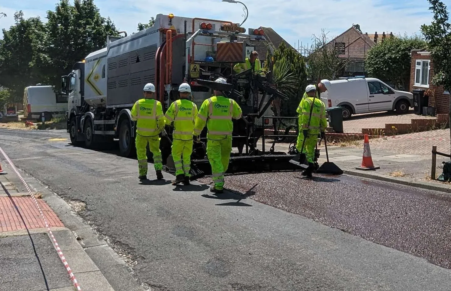
Crews at work laying new surfacing as part of the council's resurfacing programme
Brighton & Hove's highway network, by the numbers
The council's Local Highways Maintenance Transparency Report sets out the full scale of what it maintains across the city.
View the full network and asset breakdown
| Road type | A Road | B and C roads | U roads | Total Roads | Footways | Other Public rights of way | Cycleways |
|---|---|---|---|---|---|---|---|
| Length (km) | 62km | 67km | 480km | 609km | 976km | 159km | 49km |
| Asset group | Inventory |
|---|---|
| Highway Structures | 51 Bridges, 93 Retaining Walls, 11 Pedestrian subways, 3 Footbridges |
| Highway Drainage | 20,496 Gullies, 4,977 Soakaways, 4.5km drainage channels |
| Street Lights & electrical infrastructure | 20,315 Street Lights, 2,314 lit signs and posts, 1,490 Lit and reflective bollards, 112 Belisha Beacons, 298 Subway lights, 19 School amber warning signs, 593 Feeder pillars |
| Traffic Signals & ITS infrastructure | 1,734 Traffic Signal poles, 1,635 Traffic Signal lanterns, 1,572 Pedestrian crossing lanterns, 71 cycle signal lanterns, 113 CCTV cameras, 20 Variable message signs, 34 Vehicle-activated signs, 187 Real-time information signs, 54 Automatic traffic counters |
| Road Signs | 39,353 Signs |
| Road lining and markings | 752km of road markings |
| Safety barriers and features | 11.8km of pedestrian guard rail, 4.5km of vehicle safety barriers, 15,819 Safety Bollards |
| EV charging | 410 EV charging points |
| Bus Shelters | 1,497 bus stops/shelters |
| Cycle Parking | 2,023 Cycle stands, 152 Cycle Hangers |
| Grit bins | 427 grit bins |
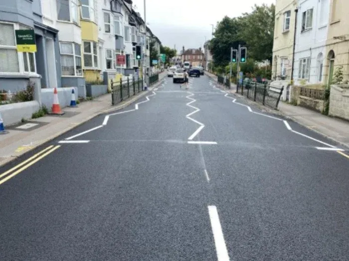
Fresh surfacing and new road markings completed at a Brighton junction
Six years of highway maintenance spending
View the spending and pothole-repair figures
| Year | DfT capital allocated | Capital spend | Revenue spend | % preventative | % reactive |
|---|---|---|---|---|---|
| 2025 to 2026 (projected) | £5,283k | £5,283k | £2,210k | 71% | 29% |
| 2024 to 2025 | £3,687k | £3,738k | £1,992k | 65% | 35% |
| 2023 to 2024 | £4,269k | £4,463k | £1,900k | 70% | 30% |
| 2022 to 2023 | £3,274k | £3,936k | £1,647k | 70% | 30% |
| 2021 to 2022 | £3,274k | £4,615k | £1,398k | 77% | 23% |
| 2020 to 2021 | £2,699k | £4,425k | £1,612k | 73% | 27% |
It costs, on average, £200 per square metre to repair a pothole in a failed road, but just £10 per square metre to treat a good road and prevent potholes forming in the first place.
| Year | 2020-21 | 2021-22 | 2022-23 | 2023-24 | 2024-25 |
|---|---|---|---|---|---|
| Potholes filled | 8,353 | 3,577 | 3,163 | 4,805 | 6,027 |
Shirley Road in Hove, one of the roads treated with micro-asphalt as part of last year's programme
How the condition of local roads has changed
In 2023/24 the council moved to a new, more accurate survey method, which is why red-category percentages jumped in 2024 despite no major change on the ground.
View road condition by category, 2020–2024
A Roads
| Year | Red | Amber | Green |
|---|---|---|---|
| 2020 | 8% | 39% | 53% |
| 2021 | 6% | 34% | 60% |
| 2022 | 6% | 32% | 62% |
| 2023 | 6% | 38% | 56% |
| 2024* | 18% | 26% | 56% |
B & C Roads
| Year | Red | Amber | Green |
|---|---|---|---|
| 2020 | 5% | 28% | 68% |
| 2021 | 4% | 29% | 67% |
| 2022 | 4% | 27% | 69% |
| 2023 | 4% | 27% | 69% |
| 2024* | 15% | 23% | 62% |
Unclassified (U) Roads — % in Red category
| 2020 | 2021 | 2022 | 2023 | 2024* |
|---|---|---|---|---|
| 16% | 13% | 11% | 12% | 8% |
*From 2023/24 the council moved from SCANNER laser-survey technology to an Annual Engineers Inspection, giving a more realistic picture of the network but making pre- and post-2024 figures not directly comparable.
What 2025/26 funding is delivering
View the 2025/26 spending breakdown
| Asset group | DfT funding | Outputs |
|---|---|---|
| Roads | £3,950k | 131,327m² preventative maintenance; 35,894m² resurfacing; 45,104m² large-scale patching |
| Footways | £628k | 10,000m² preventative maintenance; up to 35 footways getting large-scale patching |
| Highway Structures | £300k | Strengthening the East Cliff wall supporting Madeira Terrace and Duke's Mound retaining wall |
| Drainage | £100k | Repairing drainage at 10-15 key flooding sites across the city |
| Street Lights | £100k | Preventative painting of up to 360 cast iron lamp columns and swan neck brackets |
| Traffic Signals | £150k | Upgrading up to 2 existing traffic signal junctions/crossings |
| Asset Management Framework | £55k | Condition and risk surveys, condition projection modelling for two further asset groups |
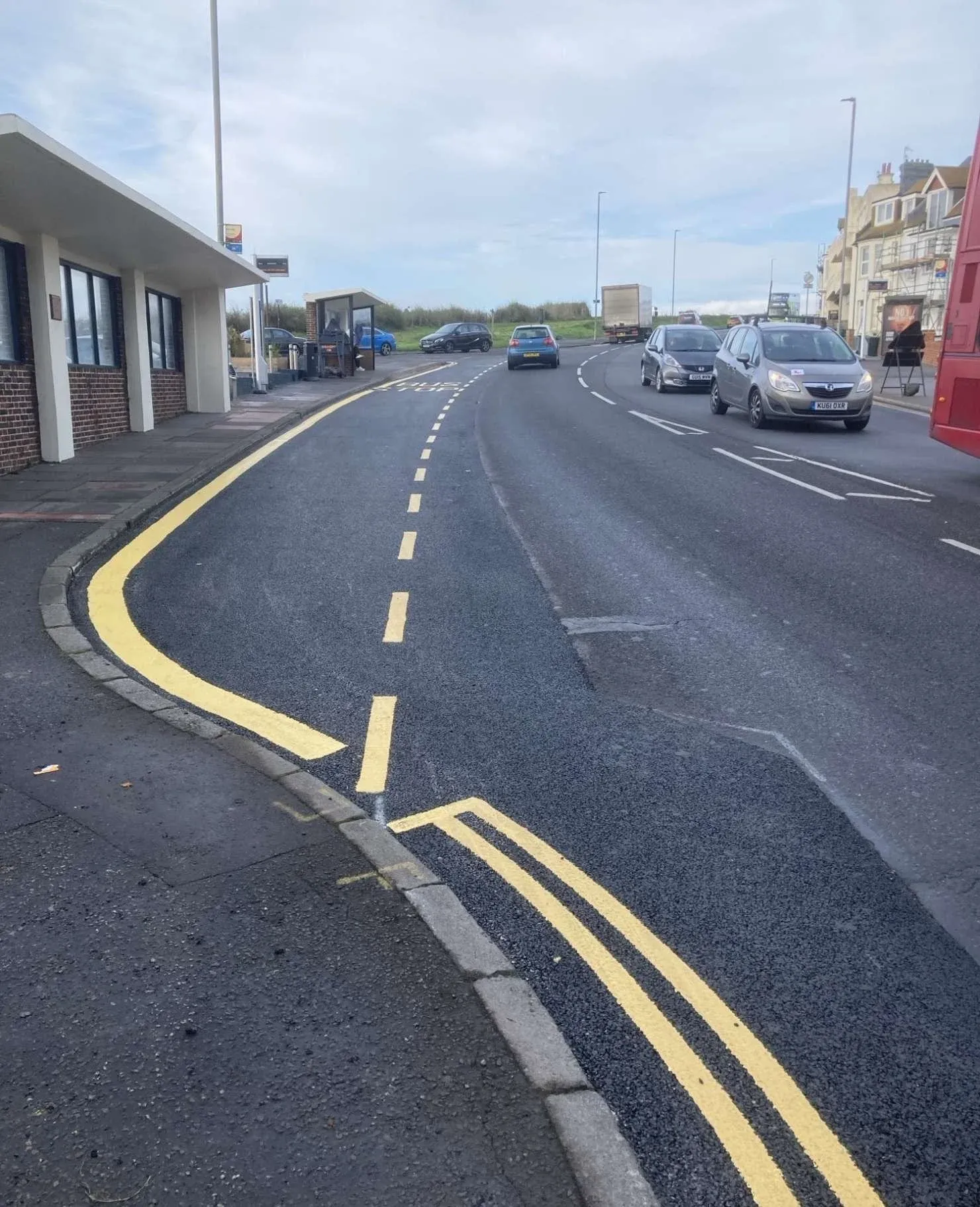
Road markings renewed alongside resurfacing work on one of the city's busier routes
How the council decides what gets fixed first
Once defects begin to appear regularly on a road, it has structurally failed and needs resurfacing. There isn't enough funding to resurface every failed road at once, so the council prioritises repairing investigation-level defects to keep roads safe until a structural resurface can be funded.
The lifecycle approach
The council follows a data-led lifecycle asset management approach, a technique used by most local authorities to monitor and predict the future condition of highway assets so they know which roads to treat, how, and when, in order to maximise each asset's lifespan. This reduces whole-life cost and carbon over time, and includes cost-effective preventative treatments applied while surfaces are still in good condition, so good roads stay good for longer.
How the programme is prioritised
Annual condition survey data identifies what treatment each road needs, then value management prioritises the works in two stages. Stage 1 is an automated process weighing road condition, predicted deterioration rates, inspection reporting, the road's place in the maintenance hierarchy, historic reactive maintenance costs, proximity to key services, and ride quality. Stage 2 is a manual filter based on engineering site assessment, proximity to live or upcoming development and capital projects, road space availability such as planned utility works, lifecycle budget allocations, and a review of scheme-level cost and affordability.
Full details of how the 2025/26 Highways Maintenance grant funding would be spent were agreed by members at Full Cabinet on 24 April 2025, with an indicative road improvement programme also published. As plans are finalised, the council publishes details of upcoming road surface improvement works on its website and promotes them on social media and in the press.
Managing streetworks on the network
Streetworks cover all works carried out on the public highway, whether by the council or third parties such as utility companies, developers or residents. Brighton & Hove has had a road permit scheme in place since 2015 to manage works through better planning, scheduling and coordination, and the Permit Team meets with utility companies and contractors every month.
A Section 58 notice is raised ahead of any planned resurfacing work, protecting newly laid roads and footways from being dug up by utilities for 3 to 5 years afterwards, barring an emergency. Working hours are restricted near schools where feasible, wide loads follow designated routes, and all permitted works are visible to the public on One.Network. Permit Inspectors monitor works on the network and take action against organisations that don't comply with permit conditions or standards.
Climate and long-term resilience
Brighton & Hove City Council declared a climate and biodiversity emergency in December 2018. Key initiatives to decarbonise maintenance operations in recent years include adopting the data-led lifecycle approach to key highway assets described above, intended to maximise asset life and reduce both cost and carbon impact over the long term.
A four-year funding settlement, and a £57m backlog
In previous years the Department for Transport allocated funding annually. This year the council has been told what it will receive for the next four years, which officers say allows for better long-term planning. The maintenance programme is complemented by £3.3 million of funding from the Local Authority Bus Grant and £900,000 of Active Travel funding.
Despite the investment, the council's Local Highways Maintenance Transparency Report shows there is currently a £57 million maintenance backlog on carriageways and £39 million on footways. The objectives set out in Our City Transport Plan 2035 guide how funding is prioritised: a safe, inclusive transport system, well-maintained streets and pavements, and active travel choices for all.
"Making our streets better and safer is vital for making sure we keep our city moving. More than £6 million will be spent on repairing and maintaining our roads in the next year, with over £1 million for improving pavements across Brighton & Hove. Knowing how much money we're going to receive over the next four years means we can plan better to meet them."
Councillor Trevor Muten, Cabinet Member for Transport and City Infrastructure
Find out what's happening in your area
Residents can check roadworks and events happening in their area using One.Network, a map updated daily with reports from the council and utility companies. Full details, including every road on the current programme, are on the council's Road Maintenance Programme 2026 to 2027 page.


Comments
No comments yet. Start the conversation.